The Big Island is Amazing

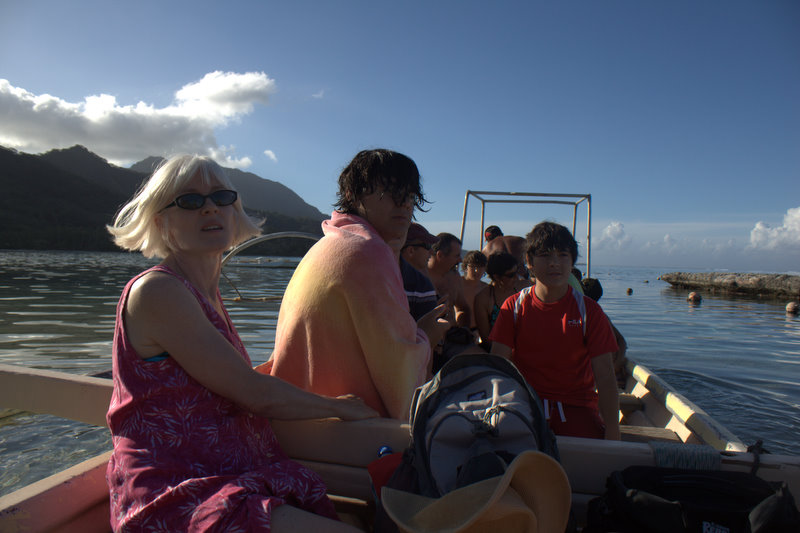
Back when Seven and I lived on Oahu we were much too broke to go touring around so we never visited any of the other Hawaiian Islands. This time we thought we should do better, and we decided to go to the Big Island because our friends Ann and Joel — with whom we have for several years spent a week in August on Cuttyhunk Island in Buzzard’s Bay (a little closer to home) — have family on the Big Island they were planning to visit. So we thought we’d catch up with them there for the very last leg of our long voyage.

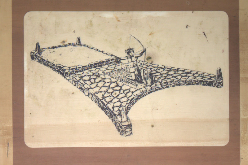
My reasons for choosing the Big Island had therefore little to do with what I thought I might learn there (though, of course, every island is interesting to me) with the consequence that I was quite unprepared and absolutely amazed by what I saw.  Like, for instance, these fantastic petroglyphs!

IMG_5355-1

IMG_5353-1

IMG_5348

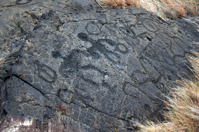
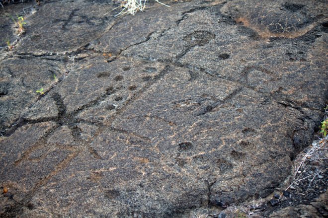
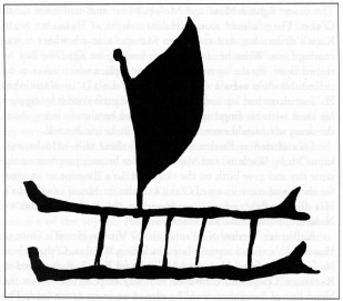
Not all of which may be terribly old. Apparently the site is still used (or was recently) by Hawaiians who, like many Polynesians, bury a new baby’s pito (or umbilicus) somewhere special to ensure a long and good life. Some of these markings have to do with that practice (the circles and divets, particularly), and I have no way of knowing which are recent and which might be old. Still the turtles and figures and even, I thought, a stylized canoe, were all extremely cool.

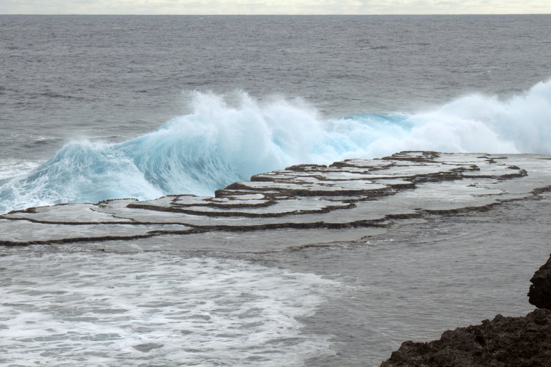
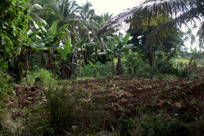
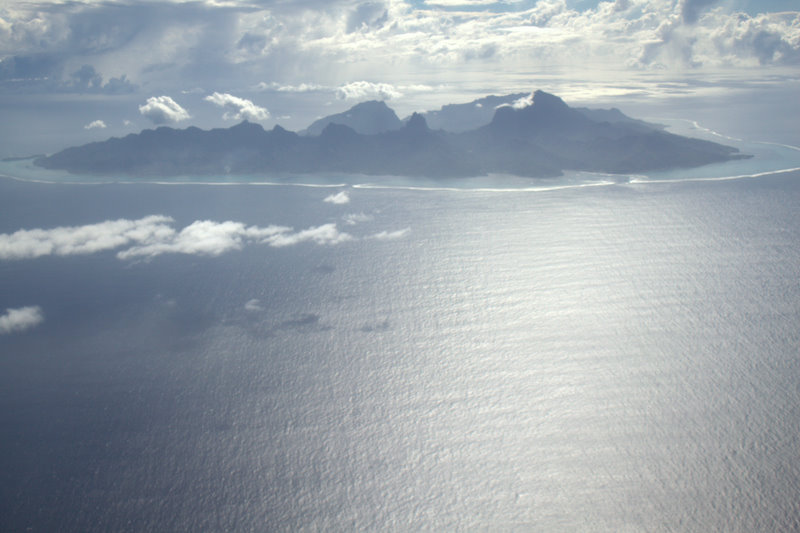
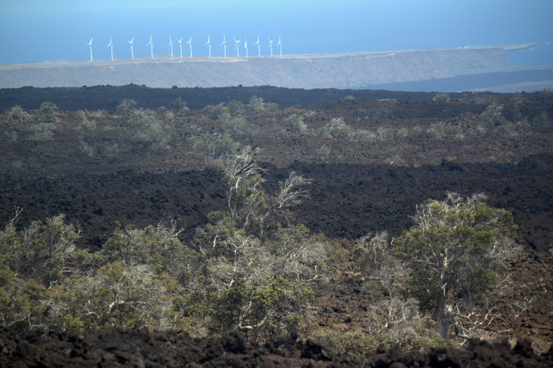
But the Big Island is amazing for so many reasons, not least because it is a window on an earlier geological stage of many of the islands we’ve been visiting. As I found myself saying over and over: This is what all the islands must have looked like when they were young. All the other high islands I’ve seen are remnants of volcanoes, shards of the cone or the crater’s edge worn down by millions of years of wind and rain. But what’s amazing about the Hawaiian chain is, of course, that it includes an island that is still in the process of being formed!

I have to report that we did not quite make it to where the hot lava is flowing into the sea, but it hardly mattered since there are distinct and obviously comparatively recent lava flows everywhere you look: A’a lava — the sharp, broken kind that is supposedly called a’a because that’s the sound you make when you walk on it (I wonder if this is etymologically correct, it is what everybody tells you…):

aa lava

and pahoehoe lava, which is smooth and sometimes  almost shiny:

IMG_5412

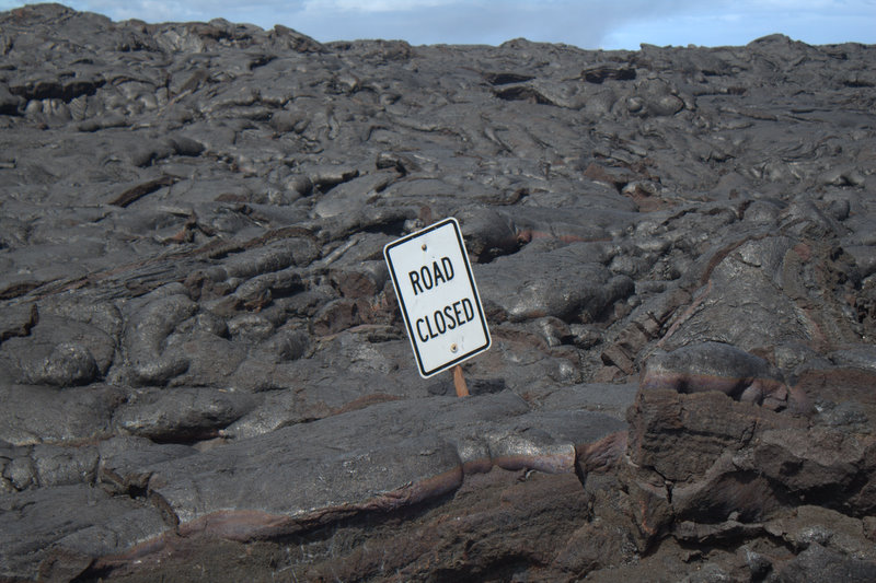
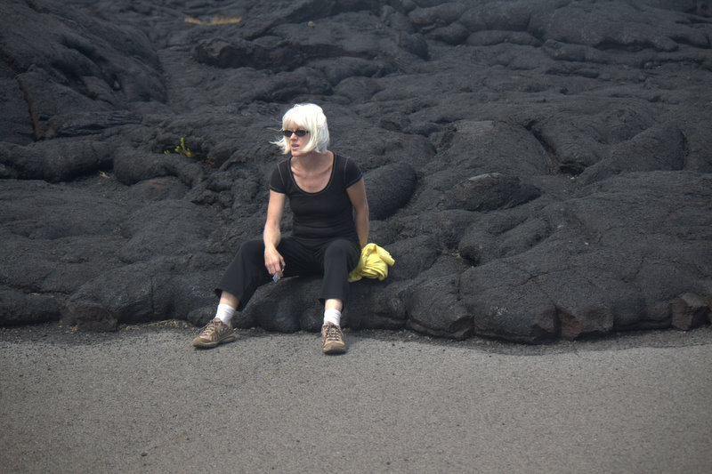
Here is a photo of yours truly sitting at the edge of what I think was the 1992 flow in the National Park that reached the ocean and cut off the road.

me and the lava

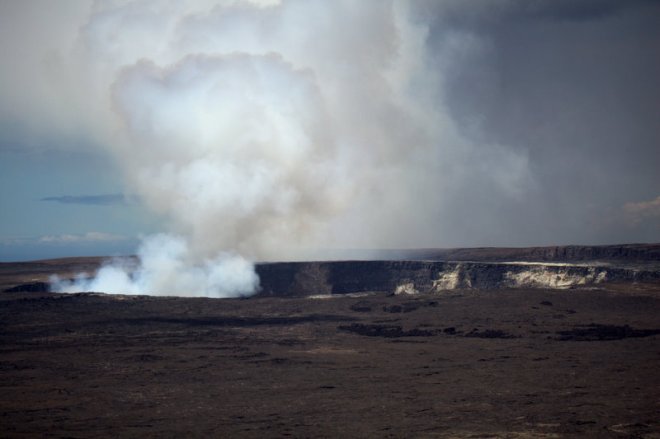
We also paid a visit to the volcano goddess Pele’s home: the Kilauea crater, which was emitting large clouds of poisonous gas and steam (which were blowing away from us fortunately)….

kilauea

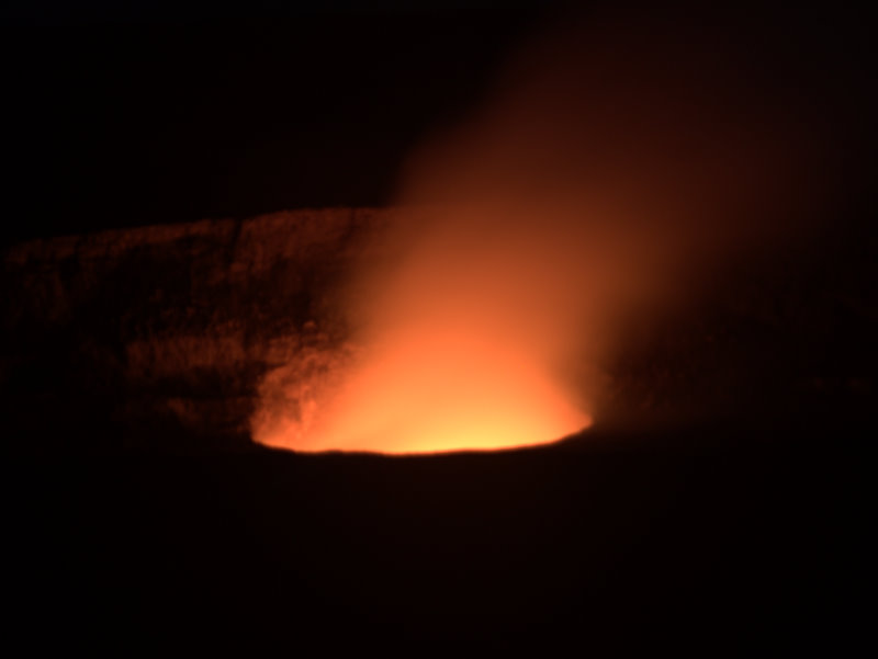
…and glowing magnificently red and orange at night!

kilauea at night

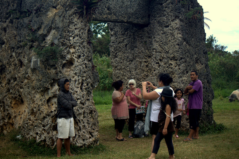
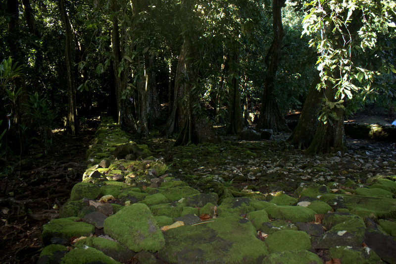
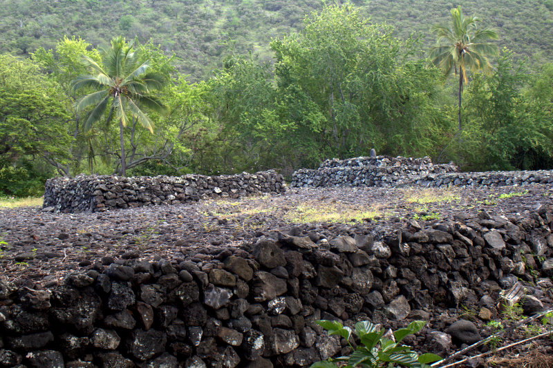
There were also more marae (or heiau as they are called here). This is the one at Kealakekua Bay, where Captain Cook’s career came to an abrupt and unexpected end:

heiau

Cook was killed by Hawaiians who had mysteriously welcomed him not long before. (Note to those who are interested: for a fascinating debate on the meaning of these events see Marshall Sahlins v. Gananath Obeysekere; other interesting writers on the subject are the anthropologists Nicholas Thomas and Anne Salmond and, for sheer elegance of storytelling and prose, the British historian Glynn Williams.)

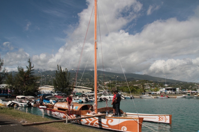
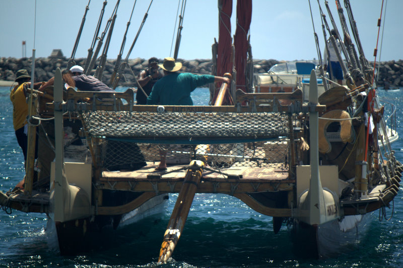
But, for me, the absolute high point, and indeed one of the most moving moments of this entire trip, was the glimpse I got of the Hokule’a, the first Polynesian voyaging canoe to have been built in perhaps 800 years and a vessel I have been reading about for years. It would be hard to overstate the significance of this canoe; it was the one that sailed from Hawai’i to Tahiti on the first attempt to re-enact the ancient voyages and thereby demonstrate experimentally how it might have been done.

Hokule'a

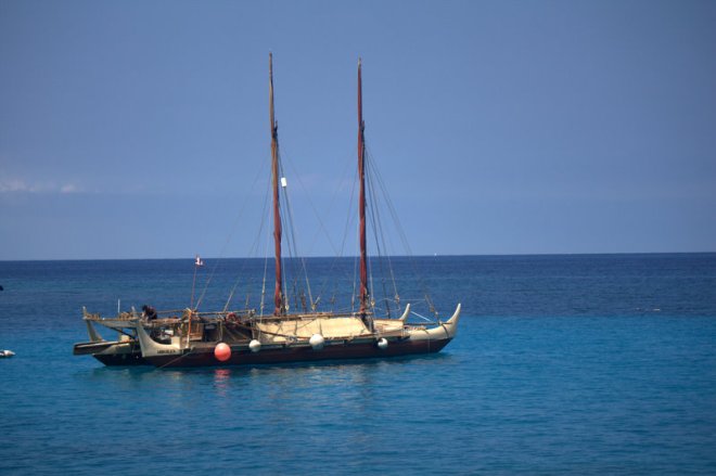
Here she is being towed out of the harbor,

hokulea

and here is another canoe called the Makali’i which was tied up nearby:

makali'i

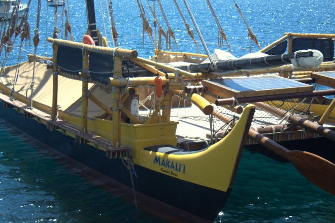
We were particularly pleased to see this one because Makali’i — in its Maori form as Matariki — is Dani’s middle name; it’s a widespread Polynesian name for the Pleiades. Hokule’a, incidentally, is Arcturus, Hawai’i’s zenith star.

Thanks You’s All Around

A Very Quick Tour

Tonga is such a complex place: this incredible hospitality; almost no tourist infrastructure to speak of (they burned the city of Nuku’alofa down in a fit of civil unrest a couple of years ago and there are still places that have not been rebuilt); a lot of highly visible poverty; an enormous number of churches; oh, and did I mention that it’s flat?

The island is like a big coral biscuit, the windward side of which is undercut in places leaving these amazing limestone shelves with holes (and even caves) in them. Up on the western end there are a series of blowholes that are not to be missed where the surf comes roaring up and crashes into these cliffs, blasting up through holes in the surface exactly like a whale. Even sounds like a whale clearing its blowhole.

windward coast Tonga

Here are a couple of shots of what you’re walking on when you get out to the edges of the island (that is where it’s not mangroves and mud):

coral

coral

And here’s what it looks like from another angle:

Tongan coast

We also visited the Ha’amonga ‘a Maui Trilithon, but which I believe is the largest megalithic structure in the Pacific outside of Easter Island. Here it is, with some people we met there for scale.

Ha'amonga Trilithon

This, actually, is what I went to Tonga to see, because until you see something with your own eyes….well, you’re pretty much just faking it.

In the Kingdom of Tonga:

Food and Friends

In the Kingdom of Tonga: First Impressions

Abraham left us in New Zealand and made the 24+ hour journey home, emailing us from LA to say that he had lost his wallet in Auckland after going through passport control but that the immigration officers had helped him find it. This did not surprise me terribly (either that he lost it or that they helped him), as the New Zealand immigration and customs officers are by far the  nicest we’ve met.

We were all very sad to see Abraham go and wished he could have traveled on with us, but he had to get back to his summer job. We, meanwhile, got on another plane and headed for the Kingdom of Tonga, our very first view of which looked like this:

arriving in Tonga

The people in the lines definitely did not match up with the signs over the lines (the people in the  so-called Special Lane looked exactly like the people in the Tongan Passport Lane, who resembled a lot of people in the Non-Tongan Passport Lane), and somehow we managed to be the last people to go through any of the lanes, though we were by no means the last people to disembark. This, as it turned out, was typical of our experience in Tonga, where we frequently had the feeling that we were missing some crucial piece of information.

In order to fully understand our Tongan experience you need to know that my niece is a kindergarten teacher in California and that her mentor teacher this past year was a Tongan woman named Ana. Now I have never met Ana, though I am hoping to catch up with her in San Francisco on the way home, but I did call her for advice some months ago when I first decided that Tonga should be on our itinerary. She was extremely friendly and helpful and suggested, among other things, that we bring a jar of peanut butter for Dani so that he would have something to eat. What I didn’t realize—what none of us realized—at the time was what it would mean to have a Tongan contact once we actually reached the Kingdom.

We arrived about 8 pm—it was dark, and we were hoping to be met by someone who would take us to the place where we were staying. But when we finally emerged from the airport there were not one but two people waiting for us. The first was the driver from the hotel; the second was Ana’s brother-in-law Sateki, who was making his—wait for it—second trip to the airport that day. Apparently there were two flights in from NZ that day, the first of which  had arrived at 2:30 am, and not knowing which of them we would be on, he met them both!

This, however, was just the beginning. After dropping us at our hotel, Sateki drove all the way back home (about 40 minutes) and then returned in a different vehicle which he was giving us to use for as long as we were in Tonga. He and Seven then drove back to his village, Sateki pointing out the landmarks in the dark and Seven memorizing the turns—left at the China Aid sign, left then quick right, left again, past two villages—through a landscape that looks something like this in daylight:

IMG_3165-1

Amazingly Seven succeeded in finding his way back to us by about 1 o’clock in the morning.

By then it was Sunday morning (early) and it turns out that EVERYTHING is shut in the Kingdom of Tonga on Sundays. I do not, by the way, recommend scheduling a Saturday night arrival for anyone considering a visit to Tonga; we, of course, had completely failed to grasp how closed everything would be. There are no stores, no tourist offices, no rental car agencies, no banks, and most importantly almost no restaurants open on Sunday. Had we not had the use of Sateki’s car, we would have been sitting in our bungalow getting hungrier and hungrier—not to mention thirsty since you can’t drink the water in Tonga (you can’t, by the way, drink the water in most of Polynesia)—until Monday morning. Again, this only dawned on us slowly, but over the course of the next couple of days we realized what a lifesaver the loan of this vehicle really was.

Here’s a shot of the place where we did, eventually, find a meal at the westernmost end of the island:

Sunday lunch

This was a sort of  “resort” and at first it looked more or less recognizable, but even here we seemed not to really get what was going on. Here is a picture of us waiting in what we thought was the restaurant—we had by this time ordered food, though admittedly off a rather confusing menu  from a girl who didn’t speak much English, while the few other people who came and went only ever seemed to have drinks…

waiting for lunch

An hour and a half later, we discovered that what we had ordered was lunch, not breakfast, that it wasn’t served until after 1 pm, that it was served in another place entirely, and that it consisted of yummy but completely foreign foods, not one of which we could even tempt Dani into trying. I tried to explain to him that the round purple starchy slices were just a kind of sweetish potato and that chicken was chicken no matter what it looked like, but he wasn’t having any of it. Seven, however, was ecstatic over the feke (octopus) in coconut cream, kumara, and something we think might have been cassava. Not for the last time did I wish I’d brought the peanut butter like Ana recommended…

A Very Quick Tour

The Last Uninhabited Land

New Zealand is certainly an interesting case in the great Polynesian migration story. Settled last and so different from all the other islands in climate, flora, fauna, etc. that it must have come as a real surprise. I begin to see the significance of a detail in the stories of Kupe the explorer, who is said to have discovered Aotearoa—see the following plaque from the monument atop One Tree Hill.

plaque on one tree hill

Kupe returned from New Zealand to report that although he had sailed right round the islands he never met with another human being. The only inhabitants were birds.

If you think about how big New Zealand is, and how resource-rich compared with many of the Pacific islands, it really would have been remarkable to have come upon it, so late in human history, and find it completely unoccupied. Nor is it surprising to find a mention of the birds, which in the absence of competitive and/or predatory mammals, had evolved in some pretty spectacular ways. One species of moa was said to be 12 feet tall.

I’d really have liked to have made a pilgrimage to Wairau Bar, where they made the first major discovery of materials from the so-called Moa-hunter period; the earliest phase of Maori settlement of New Zealand. But I guess I’ll have to come back to do that because, you guessed it, we still have more family members to see.

New Zealand: Parting Shots

I can’t resist…

…posting a few more shots from Rangiroa, because it’s so cool and so remote, and because I may never get there again and most people never will. Some of these photos were taken by Abraham and some by Seven; occasionally we discover that the same photo has been taken by both. Shall we start with flowers?

red flower

yellow flower

blue flower

Now how about luggage? Note the addition of Abraham’s turquoise bag!

luggage

Here is a shot of the surf hitting the reef (the open ocean side of the atoll):

surf on the reef

and here is one taken at Avatoru Pass. This is one end of the 12 km road:

Avatoru Pass

Here is one of Abraham:

abraham

and here is one of Dani standing at the edge of the lagoon:

Dani at the edge of the lagoon

Shifting Gears

An Atoll at Last

On our first night on Rangiroa, Seven and I were strolling along the road and I said, “So, what’s different about this place from all the other places we’ve been so far?” Answer: no mountains. The temperature is the same, the sea is the same, the plants are the same, even the sand is the same. But the mountains, which on a high volcanic island dominate one’s sense of the place (maybe even more than the ocean if that’s possible), are simply missing.

An atoll is, in effect, the memory of a volcanic island which has subsided into the sea leaving only its encircling reef. Here is a part of one from the air:

an atoll

And here, btw, is what you land on. atoll landing strip

The Tuamotu Archipelago is a string of coral rings running NW to SE about halfway between Tahiti and the Marquesas. Rangiroa is the largest of them; it is, in fact, so large that you could fit the entire island of Tahiti inside it, which means, of course, that you can’t see to the other side (or even close!) when you’re looking across the lagoon. What you can see across is the strip of sand that passes for the island. Here is a photo Seven took standing on the open ocean side and looking across at the lagoon. That’s how wide the island is — not very!

rangiroa

These rings are typically not continuous; they have breaks, or passes in them through which the lagoon empties and fills. On Rangiroa the town, airport, hotels, houses, etc., are spread out along a 12 km stretch of road (there are lots of cars, which seems insane, since there is nowhere to drive except up and down this stretch), at either end of which there is a break in the reef. At the Tiputa end, the pass is narrow and seemingly pretty deep and the water rips through it at the turn of the tide. It’s famous for the dolphins that come there to feed when the water flows out of the lagoon, bringing, presumably, lots of fish with it, and by some miracle Seven and I just happened to be there at the right time of day:

dolphis at Tiputa Pass

The whole time we were on Rangiroa the wind was blowing like crazy — nothing to stop it, I guess, for hundreds (thousands?) of miles, and the lagoon, which we faced from our bungalow, was almost as wild-looking as the open sea. Apparently this is typical of July — a strong, steady southeasterly. The boys did get one swim in off the jetty in front of the hotel, as you can see:

swimming at rangiroa

though it was so rough I could barely watch (Seven went with them, so that was ok). Apparently they saw lots of things — the Tuamotus are a famous destination for divers — but then when they came out of the water Seven spotted this sign:

poisson

He was the last one back to the bungalow and he came in laughing about how he’d seen this sign about a poison Tigerfish (!) and then he read about another kind of poison fish, and then another and another, and suddenly he thought, “Holy shit, they’re all poisonous!” I think it might have been the stonefish we saw in ‘Opunohu Bay that put the wind up him initially…

I am now going to leave you with my favorite Rangiroa picture. There is something about the arrival and departure of planes on these small islands — I remember the feeling from Rarotonga back in the 1980s when the plane only came once a week, and when you heard it go you knew it would be another 7 days before it came back for you. The planes are much more frequent everywhere now — there were certainly a couple a day on Rangiroa (even the odd private jet) — and yet there still seems to be something a little forlorn about the sight and (especially) the sound of them approaching and leaving these remote little specks of land…

plane arriving on Rangiroa

I Can’t Resist…

Land, Sea, and Air

The day before we left Mo’orea, Seven and I went to pay a call on Marimari Kellum, whose grandfather came out to French Polynesia from the States at the beginning of the last century and, for a time, owned the whole ’Opunohu Valley (her father ended up giving most of it to the Territoire). Kellum’s son, Hiria Ottino, has just embarked on an amazing journey, retracting the ancient Polynesians’ migration route in reverse all the way back to China, and he actually IS sailing! Here is a photo of the canoe he will be  traveling in:

O Tahiti Nui Freedom

and a link to the website for anyone who wants to know more: http://otahitinui.com/vaa/en. Here’s to a safe and enlightening journey. Bon voyage!

Our own little party, meanwhile, also finally managed to get out on the water, albeit for a 5-minute lagoon crossing, but it might still have been one of the highlights of our time in Mo’orea. We went out to the Lagoonarium (not to be confused with the lagoonarium at the Tahiti hotel), which is a little motu out on the reef with places to sit and drink coffee and snorkels and kayaks that you can borrow. Here is a picture of us going across in the boat:

at sea

As per our normal routine, Seven and the boys went snorkeling and saw tons of cool things while I sat in the shade and worked. Lest anyone think I am just idling away my time, I am posting some evidence of my activity.

Here I am working in the forest:

me working in the forest

And here I am working in a restaurant:

me working at a restaurant

It’s okay though, I’d as soon read as snorkel, and, to be honest, I am a little afraid of the sun. One of the ironies of the trip so far is that the only person who has managed to get sunburned is Seven (the hubris of the naturally dark-skinned), whereas I have been neurotically careful.

But to get back to the lagoon, the color is just astonishing. As you go from the beach to the reef and back again you pass through a spectrum of blues from the palest aquamarine through series of deeper and deeper turquoises to a dark ultramarine. This isn’t quite as vivid as what we saw, but it gives you an idea:

water colors

The colors of Polynesia are, generally speaking, difficult to exaggerate – they are already exaggerated. This is, incidentally, one of the interesting things about Gauguin’s Polynesian paintings: how dark, even gloomy, the palette is when you consider the vividness of the colors in these islands and the clarity of the light. There are lots of interesting possible explanations for this, some having to do with Gauguin’s state of mind and some having to do with what was going on in the islands. Many Polynesian populations reached their nadir in the late 19th century; in the Marquesas, for instance, a smallpox epidemic in the 1860s is said to have wiped out 2/3 of the population.

The thing about boats is that they enable you to see these islands as they were, until very recently, always seen. I have been preoccupied with this idea for quite a few years now, though how far it gets you along the path toward understanding what an island rising from the horizon actually meant (to voyagers, raiders, explorers, castaways, etc.) is unclear.

Now, of course, we have this other way of seeing islands — from above. I wonder how that changes our understanding of them?

island from the sky

An Atoll at Last

More Mysterious Stonework in the Forest

Up in the ‘Opunohu Valley on Mo’orea there is a very intriguing marae complex with a large number of excavated platforms (many with large trees growing inside),

IMG_1686

and, if you wander a bit farther away, lots more of what look like unexcavated platforms.

IMG_1724

It was obviously an enormous complex back in the day. The valley itself is wide and deep and has a river running through it, so it seems not at all surprising that there would have been a large and powerful population residing here. The platforms are scattered through a glade of mape trees — this is the tree with roots like drapery, sometimes called the Tahitian chestnut — which seems to lie at a certain altitude on the mountainside. As you get up out of the glade, you also leave the marae area behind. The fact that there are large trees growing inside the platforms suggests how long they have been abandoned, but it also made me wonder if these trees grew here in the days when the platforms were in use. They are particularly beautiful, tall and sinuous, with these astonishing roots:

mape tree

As to whether there were such trees on the marae compound 200 hundred years ago, you could probably answer this question by looking at the engravings from the early European expeditions (no copies of which I happen to have with me at the moment). The 18th and early 19th c. explorers had artists with them who recorded — I think remarkably faithfully — the places they saw. I have been struck by how much the coastline in this bay looks like the drawings that were made on Cook’s voyages — in fact this is one of the places he stopped. They also shot the 1984 Mel Gibson/Anthony Hopkins Bounty movie here, which we watched the other night. I thought the scenes with the Tahitian girls were ridiculous (were they instructed to giggle hysterically as they were being hauled by the sailors onto the ship?). It was fun, though, to see the line of the mountains in the movie exactly as it looked off our deck.

And here is a little mystery. Up by the marae Seven and I read about something that was described as an “archery platform.”

archery platform image

This was news to me; I had always understood that bows and arrows never made it to Polynesia. The text at the site suggested that the ancient Polynesians used the bow for contests only, i.e. not for war (and that this was a measure of their good sense). But, if it had been me, I would certainly have used it for hunting. An excellent way to catch the birds they brought with them, which, despite being nominally domesticated, run wild all over the islands, crowing from dawn to dusk. Ah, the sound of Polynesia…

Polynesian rooster

Land, Sea, and Air

It’s All Relative

Compared with the Marquesas, and even sleepy Ra’iatea,  Mo’orea feels positively metropolitan. Our first attempt to go to the beach took us through a hotel compound of bungalows and paved paths, a restaurant by the water, a place to rent kayaks, a dive center, etc. Dani (who has certainly been spoiled by his first taste of a Pacific Island beach in the Marquesas) had an almost violent reaction to the level of development. You may judge for yourselves, however, just how bad it was (that’s the four of us in the center):

Les Tipaniers

Maybe 20 people on the beach, 5 in the water, and another 10 sitting at the restaurant or wandering around – not exactly Wingaersheek on a July weekend…

There was, however, quite a lot of activity in the water. The wind was high and there were some astonishingly acrobatic kite-surfers flying around the lagoon and leaping over the dock, which was amazing. Dani, Matiu, and Abraham took a couple of kayaks and set off down the lagoon.

boys in kayaks

They were headed downwind and it occurred to me that they might have some difficulty returning. Indeed, in almost no time we lost sight of them. So Seven jumped into a kayak and set off in pursuit. About an hour later they reappeared, trudging through the lagoon, dragging their kayaks behind them.

This question of access to the beaches is interesting. We have been told twice by locals that you can just go into the big hotels and go to their beaches, but the larger hotels are obviously trying to stop people from doing this because they’re gated. We made an experiment along these lines the other day and were instantly stopped by the guard who asked Seven where he was going. I then got out on my side of the car (I don’t think the guard could see me; I was in the back seat on the opposite side) and spoke to him in French:

Was there a beach?

It was not public; there was a public beach down the road.

Was there a restaurant at the hotel?

Yes.

Then we would go to the other beach and come back to the restaurant later.

It’s funny about these encounters, I never know exactly how much they are genuinely charged and how much I am bringing to them in the way of expectation. But I certainly did get an adrenalin surge, or, to put it another way, it didn’t feel very friendly. From there we made our way to the public beach which was full of picnicking Tahitians (a little bit more of the Wingaersheek feel). That has its own challenge in a way. As Abraham noted, our local cred is better when we have Seven with us. (Matiu, who is the brownest of our children, is rapidly darkening in this sun and will pass for local pretty soon).

Finally, a nice shot of fish from off the dock somewhere…

IMG_1442

The Eclipse

A Linguist’s Paradise

Thought you might enjoy this photo of Seven a la mode Tahitienne. Actually, I believe only the women wear flowers in their hair, but I think it suits him.

Seven with hibiscus flower

Seven is definitely still provoking interest, especially among the Islanders, and all our most interesting encounters have been with people who want to know who he is and where he comes from. One person guessed Hawaiian; another thought he might be Rarotongan. No one yet has thought to suggest New Zealand, which seems like the obvious choice, or Tongan or Samoan for that matter. This would seem to indicate that there aren’t too many non-French Polynesians traveling in these parts.

Our encounters really emphasize how separated the Pacific is by this English v. French colonial divide, but it’s frustrating seeing people with so much in common separated from one another in this very fundamental way. Maybe if his Maori were better they would have a Polynesian lingua franca, but I don’t know. Everyone tells us that speakers from different island groups are mutually unintelligible.

Or, rather they tell us that people from other islands can understand each another, but that they can’t understand them. Marquesans, we are told, sound like Maori; or Tuamotuans sound like Marquesans; or Easter Islanders sound like Hawaiians; but no one, apparently, sounds like Tahitians, at least from the Tahitian point of view. We have, however, met an interesting assortment of people from the eastern Pacific, including a  guy from Rapa Nui (Easter Island) who spoke to us in a mixture of French and English, taught us a few words of Rapa Nui, and counted out our change in Spanish!

On a completely different subject, I have become painfully aware (from questions put to me by people at home) how little I know about birds and plants and I’m sorry to report that I cannot be at all interesting on either subject. However, I did see the most magnificent pair of breadfruit trees the other day. They were so huge and glorious that I made Seven turn around and drive back about a 1/4 mile to take some pictures. (The kids were utterly bored by this; “Hey, let’s stop and take a picture” is becoming code between them for anything time-wasting and stupid). You can’t really get a sense of how big they were (this is shot down from the roadside above) but they had to have been 40 feet high at least.

breadfruit trees

This is what the leaves and fruit look like up close. Beautiful, isn’t it?

breadfruit

Breadfruit is, of course, the cargo that Captain Bligh of the Bounty was supposed to pick up in Tahiti and take to the Caribbean (where it would be grown to feed slaves) before his crew mutinied and left him to perish in an open boat. It is prepared in various ways, including most famously a fermented mash, which is, I believe, an acquired taste. Dani wouldn’t get near it…

Abraham Joins the Crew